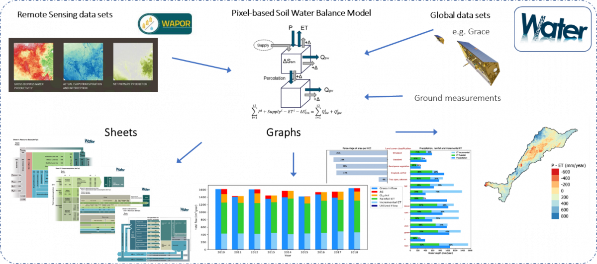
WA+ framework
The Water Accounting Plus (WA+) framework was developed to use open-access remote sensing based data for water accounting at the basin level (Karimi et al. 2013). The framework combines the RS based data with other available global data sets and ground measurements to produce standardized WA+ sheets supported by graphs, maps, and tables:
The IHE Delft WA team uses open access data and free software (QGIS and python) for all analyses and publishes the scripts on their github page.


WaPOR-based Rapid Water Accounting (WaPORWA)
WaPORWA consists of several Python scripts to use WaPOR data for water accounting analyses. The scripts were used for Jordan, Awash, Nile, and Niger rapid water accounts have been compiled into Jupyter notebooks and published to WAPORWA Github repository. This repository includes scripts for collecting and pre-processing WaPOR data, running pixel-based soil-moisture balance model to account for incremental and rainfall ET, incorporating available observed outflow data, and computing fluxes in Sheet 1 - Resource Base. The reports can be found here.
More information on the remote sensing data sets and models used to implement WA+ will come soon.